OSL Fieldwork Day One
- Ian Parker Heath
- Dec 10, 2025
- 3 min read
Optically Stimulated Luminescence fieldwork at Under Whitle: Dec 1-3 2025
As you might have read in an earlier post, a result of a successful application by the group to the Farming in Protected Landscapes (FiPL) scheme, they were able to commission specialists to undertake a programme of Optically Stimulated Luminescence (OSL) at Under Whitle. It was with much excitement then that between 1-3 December the group hosted a team of specialists who were tasked with taking samples of buried soils from a number of sites around Under Whitle.
The specialists were Prof Sam Turner (University of Newcastle) and Dr Tim Kinnaird (University of St Andrew’s) who had been working in Mexico the week before! They were ably assisted by PhD students Doris Jetzinger (University of Vienna) and Miguel Roble Dillo (University of Valencia). We were really pleased to discover that Tim had recently been in the news with his work as part of the team dating the large Neolithic pits discovered at Durrington Walls!
Day 1
Monday morning saw the team assemble and meet all the volunteers there for the day. The next task was to finalise the locations for sampling as the specialists had not seen the locations other than as photographic images, but it turned out they were all suitable with only slight changes needed. In addition to those identified, one further site was targeted which is Trench 9 on the map below. So, work began on excavating the trenches, and sadly for all concerned the rain continued to fall all morning. However, things brightened up after lunch and we were also joined by historians Drs Simon Harris and Andrew Sargent who were keen to get to grips with the archaeology of the sites. Here are the details of the sites selected.
Target locations
Trench 1 A linear earthwork which crosses the landscape for several hundred metres. It has a number of changes of direction and a section which includes a break was excavated in 2016. No dating evidence was found.
Trench 2 The terminus of a ridge (& furrow) and associated headland running down the valley side, broadly North to South.
Trench 3 A linear bank running broadly East to West. It is below a trackway which leads from the top of valley side down to the River Dove.
Trench 4 The edge of a lynchet. The lynchet was excavated in 2021 and was interpreted as being a product of agricultural activity, probably medieval in date.
Trench 5 The edge of a lynchet or boundary bank.
Trench 6 Earthwork bank approximately 2m wide on the downslope of the western valley side. Possibly the western edge of Under Whitle at an earlier date.
Trench 7 Terminus of ridge & furrow/possible headland. This area has been postulated as the area of earliest agricultural activity.
Trench 8 The edge of probable droveway across the landscape
Trench 9 The edge of the lowest of three lynchets in a field known as Main Piece and thought to be of early medieval origin.
Fig. 1. Locations selected for sampling (courtesy of Richard Knisely-Marpole)

The day progressed without too much trouble, and everyone dried out in the afternoon with a warmer than average breeze for this time of year. By the middle of the afternoon we were ready for the specialists to begin sampling. In order to get a sample each trench need to go down to the natural, that is the first layer or context in which there is no sign or evidence of human activity. Once that is achieved then a sample is taken form each context and these will provide the on-site dating. This is what archaeologists call relative dating as the results indicate the degree of stored radiation in each context – the higher the degree of radiation present, the older the sample of soil.
Gallery 1 - here are images of the locations of the trenches 1 to 9 (Nb trenches 4, 5 and 9 appear on image 3).


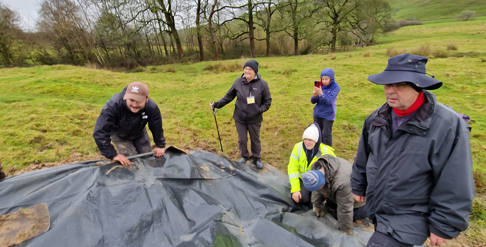
In Gallery 2 you can see how work progressed in Trench 2 from de-turfing through to sampling. Trench 2 was worked by Tim, Doris (who was under the sheeting taking samples, Rose and Andy. This trench was located at the bottom of an area of ridge & furrow which runs down the valley side from just below a house platform and forms a distinct area of the farm. The images in Gallery 2 end with one of the face or profile of the trench showing where the samples were taken.
Gallery 2


Comments